A Map of Egypt 1715 1
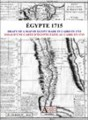
A Map of Egypt 1715An antique print from a geography book of the 18th century. The Egyptian basin of the Nile is shown and the main map is surrounded by a comprehensive city list of Egypt with historical accounts.1 scanned map of Egypt in .jpg ...
Last update
8 Aug. 2010
Licence
Free to try |
$12.17
OS Support
Windows
Downloads
Total: 405 | Last week: 4
Ranking
#103 in
E-book Software
Publisher
Screenshots of A Map of Egypt 1715
A Map of Egypt 1715 Publisher's Description
A Map of Egypt 1715
An antique print from a geography book of the 18th century. The Egyptian basin of the Nile is shown and the main map is surrounded by a comprehensive city list of Egypt with historical accounts.
If you choose e-mail shipping, you will receive immediately after completion of your payment a download link with login and password valid for 24 hours. If you choose physical shipping, you will receive the same link and, in addition, a CD-ROM copy of the map by post. Physical handling and shipping costs are 10 euros for all countries.
- 1 scanned map of Egypt in .jpg format.
- Size of 3444 x 3170 pixels x 300 dpi.
- Real size, same as the original: 29.1 cm x 26.8 cm.
- Scale in French leagues.
- Can be viewed and printed with any imaging software (Photoshop etc.)
If you choose e-mail shipping, you will receive immediately after completion of your payment a download link with login and password valid for 24 hours. If you choose physical shipping, you will receive the same link and, in addition, a CD-ROM copy of the map by post. Physical handling and shipping costs are 10 euros for all countries.
Look for Similar Items by Category
Feedback
- If you need help or have a question, contact us
- Would you like to update this product info?
- Is there any feedback you would like to provide? Click here
Popular Downloads
-
 KaraFun Karaoke Player
2.6.2.0
KaraFun Karaoke Player
2.6.2.0
-
 Kundli
4.5
Kundli
4.5
-
 Macromedia Flash 8
8.0
Macromedia Flash 8
8.0
- FastSum 1.9
-
 FastSum Standard Edition
1.6
FastSum Standard Edition
1.6
-
 Cool Edit Pro
2.1.3097.0
Cool Edit Pro
2.1.3097.0
-
 Cheat Engine
6.8.1
Cheat Engine
6.8.1
-
 My Talking Tom
1.0
My Talking Tom
1.0
-
 Hill Climb Racing
1.0
Hill Climb Racing
1.0
-
 Tom VPN
2.2.8
Tom VPN
2.2.8
-
 C-Free
5.0
C-Free
5.0
-
 Windows XP Service Pack 3
Build...
Windows XP Service Pack 3
Build...
-
 Vidnoz AI
1.0.0
Vidnoz AI
1.0.0
-
 Netcut
2.1.4
Netcut
2.1.4
-
 Facebook Messenger
440.9.118.0
Facebook Messenger
440.9.118.0
-
 Vector on PC
1.0
Vector on PC
1.0
-
 FormatFactory
4.3
FormatFactory
4.3
-
 Auto-Tune Evo VST
6.0.9.2
Auto-Tune Evo VST
6.0.9.2
-
 Grand Theft Auto: Vice City
1.0
Grand Theft Auto: Vice City
1.0
-
 Minecraft
1.10.2
Minecraft
1.10.2